 EN
EN 日本語
日本語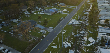
Introduction
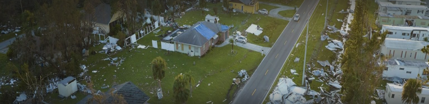
The customer is a New Zealand engineering firm. Following multiple environmental disasters, they needed a rapid, field-capable method to assess land and structural damage.
CodeComplete developed a mobile GIS app that allows users to mark affected locations on offline maps, complete customizable forms, and capture photos and videos onsite. A secure web interface enables managers to review submissions, control access, and coordinate teams.
Team size
3 members
Industry
Engineering
Technology
C#, .NET, GIS, React Native, Python, AWS
Highlights
Value Delivered
Assessment forms/inputs:
- Ability to have remedial solutions planned on-site.
- Ability to generate Cross Sections on site – multiple profiles (estimated existing land, current land profile, and remedial solution).
- Take photos, and get them straight into report.
- Standard field assessment forms/inputs.
- Prompts for the information required in the reports – multiple natural disaster event types which change the following fields of data required.
- Auto populate reports.
GIS mapping and integration:
- Ability to generate Cross Sections on site – multiple profiles (estimated existing land, current land profile, and remedial solution).
- Worked on Android planform first. Plan for near future: flexible platform – can be used on multiple devices, phones, tablets and PCs.
- Ability to connect/share with other apps/databases including BAU app tracker.
- User can make many activities on the map like: attributes added to the lines, areas to be generated from the polygons, etc.
Challenge and Solutions
- A significant challenge encountered during the development of the damage assessment application arose when, at a critical juncture in our development process, a substantial flooding event occurred in New Zealand, necessitating the immediate deployment and utilization of the application. In response to this unforeseen emergency, our team was required to swiftly adapt to the situation and expedite our efforts to ensure the application’s usability in the context of the flooding event.